Spectrum monitoring, direction finding and microwave link measurements from the air
The LS OBSERVER Airborne Monitoring Unit (AMU) is an advanced drone-based RF monitoring solution, designed to perform spectrum monitoring, direction finding, and microwave link measurements from the air. Equipped with specialized shielding and interference reduction technologies, the AMU enables high-precision signal detection, geolocation, and regulatory enforcement - even in challenging environments.
With multiple RF payload configurations and flexible deployment options, the AMU adapts to various operational needs, including battery-powered short-term missions or tethered long-duration flights for continuous data collection. Controlled via the LS OBSERVER CMS software, it integrates seamlessly into existing monitoring networks to enhance spectrum management and enforcement capabilities.
Whether for critical surveillance, interference detection, or regulatory compliance, the AMU delivers unmatched airborne RF intelligence.
Unparalleled Airborne Spectrum Monitoring Capabilities
Enhance your spectrum surveillance with precision and flexibility.
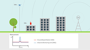
Get a clearer picture
- Fly above obstacles that absorb or weaken radio signals
- Receive signals with a better signal to noise ratio (SNR)
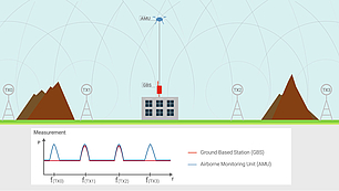
Increase coverage
- Detect more emissions than from ground level especially in urban areas or hilly terrain
- Capture a larger area for monitoring in comparison to ground-based stations

Measure microwave links
- Capture the signal inside the fresnelzone
- Cost-effective and timesaving (no lifting platforms and no climbing on buildings required)
- Measurements in inaccessible areas
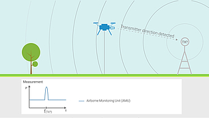
Increase DF and triangulation accuracy
- Direct line of sight to emitter
- Fly above obstacles/metal structures which reduce DF accuracy
- Achieve a better direction finding and localization accuracy in urban areas or hilly terrain
Configurable Payloads & Extended Flight Operations
Tailor the AMU to your mission requirements with specialized payloads and power options.
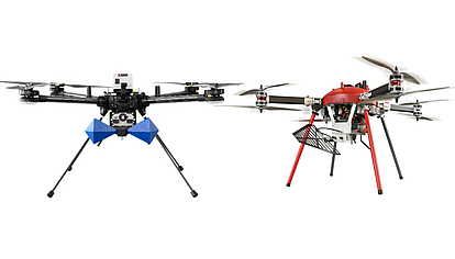
Multiple RF Payload Configurations
Attach specialized antennas and receivers based on mission needs - directional antennas for DF, omni antennas for spectrum monitoring, and high-frequency payloads for SHF/EHF applications.

Battery-Powered or Tethered Operations
Choose battery mode for flexible, short operations or tethered mode for continuous data collection and stable power supply.
User-Friendly, Mission-Optimized Software
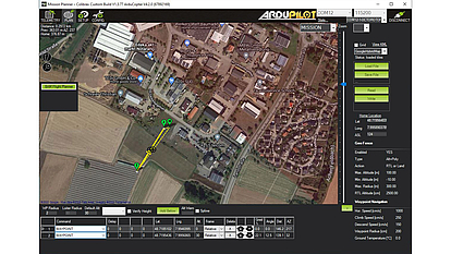
Plan, automate, and execute precise flight paths with ColMP software (ArduPilot™ based) for accurate, repeatable mission execution.
Seamless Integration with LS OBSERVER & mySPECTRA
Connect the AMU to your monitoring network for automated data analysis and compliance enforcement.
Integration with LS OBSERVER Networks
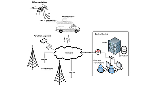
Deploy the AMU alongside fixed and mobile monitoring stations, integrating all data into a single centralized monitoring network.

Automated Direction-Finding & Geolocation
Combine AMU direction-finding results with ground-based stations for precise triangulation and interference localization.
Regulatory Compliance & Spectrum Audits
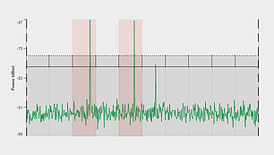
Leverage LS OBSERVER CMS and mySPECTRA to compare real vs. licensed spectrum use, ensuring compliance and detecting spectrum anomalies.

ITU-Compliant Measurements & Automation
Perform ITU-compliant signal measurements, automate spectrum audits, and detect license violations in real-time.